Roadtrek

Roadtrek
Showing posts with label Charlottesville. Show all posts

Wednesday, October 17, 2012

Monticello - Home of Thomas Jefferson, Charlottesville, Virginia

We came west in Virginia in our Roadtrek primarily for one reason, to see Thomas Jefferson's Monticello. We have been to Monticello in our pre-Roadtrek travels many times. We have not been there in several years and were eager to see the new musuem complex that was only starting construction when we were there last at least five years ago.

Monticello was built under the direct supervision of Thomas Jefferson on top of a mountain. Everyone at the time thought that this was crazy but if anyone was going to be able to do this feat, it was Jefferson. During his adult life, Monticello was a home always under renovation - add a little hear, change something there. What you see when you come to Monticello today is the building restored completely to as it was when Jefferson lived here.

To get to Monticello, you have to drive up that mountain on a road that is one lane in each direction and it winds up the mountain. You share this road with cars, trucks, and other RVs. Along the way up you pass another historic site - Mitchie Tavern which is a restored 18th Century tavern to tour with a nice gift shop and a southern buffet lunch in a small restaurant if you have time to indulge. The Roadtrek made the climb just fine. This is another of those roads that you just drive up and then later back down at a speed you are comfortable with and avoid coming too close to the edge which in some places is unprotected from the drop down. When you arrive at the turn off to Monticello you are turning right when coming up the mountain, though Monticello is to the left. The right turn brings you into a curved entrance road that is relatively new - perhaps the last ten years and this will bring you into a wooded area and then to the entrances to the parking lot. One of the first lots that you come to is an RV lot with long spaces. We were glad to see this because we recalled the car lots with steeply angled and small spaces. We pulled in and there were just a couple of other RVs parked there. There were no other Class B's.   By the time that we left at the end of the day we were the only RV in the lot, as you can see in the photo.

The parking lot is a short walk from the ticket building and the new museum complex. You are still not at the top of the mountain and the house is still above where you are further up the mountain. When you purchase your ticket you are given a starting time for you tour of the mansion which is shown on your ticket. Our tour would start in about twenty minutes so we walked through the outside of the museum complex and headed for the shuttle bus that would take us up to the top of the mountain. It is possible to walk and we usually walk down, but it is not a climb that I wanted to make in the August heat. It is a small shuttle bus and the ride up is just a few minutes. The bus filled and we were on our way up. You arrive at the top of the mountain just in front of the mansion that is surrounded by large hedges at the edge of the paved bus route. You are told to arrive at the starting point for you tour five minutes before it will start. There is more to see at the top of the mountain than just the mansion and if you are there early you have time to see them - I will tell you about them as we go along. We had just a ten minutes or so, now before our tour and we took a short walk to a small gift shop and then back to the line for the tour.  


This is what you see as you look through the opening in the hedges and start to walk up to the front door with your tour guide. You are told about the house and Jefferson's plans to build it. As you stand on the steps you are told about the single hand plantation clock that sits above the door that is run by two weights that hang from chains just inside the door and enable the clock to run for a week with the height of one of the cannonball type weights showing the day of the week painted on the wall. There is no room from ceiling to floor to fit all of the seven days of the week so you must go into the basement to see those days.

Inside the house, no photography is allowed - and there is a tour guide with you every moment inside the house so you cannot sneak any. There are some very nice books of photography inside the mansion for purchase in the bookshop in the gift store along with postcards of the inside. Inside you will see the mansion as it looked and many of the furnishings are original having belonged to Jefferson. Jefferson lived here with his wife and their children. When his wife, Martha (yes, just like Washington, Jefferson married a Martha), passed away after just ten years of marriage, Jefferson promised her that he would never marry again, and he lived in the house raising his girls. Later when they married, they remained with their families and Jefferson was always surrounded by his children and grandchildren. Entering the house you come into a large foyer which Jefferson used as an exhibit area showcasing items sent to him by Lewis and Clark on their discoveries. This is a museum in itself with artifacts from dinosaurs, wooly mammoths, and native Americans.  This is as it was when Jefferson lived here. As you walk through the house with your guide, you will see the sitting room that Martha Jefferson and later the oldest daughter used as to run the household, Jefferson's library with Jefferson's books on the shelves. Jefferson's office, Jefferson's bedroom with the bed that Jefferson slept and died in, a parlor, two dining rooms. You exit the house through a bedroom that was the favorite for Mr. Madison and his wife Dolly to stay in when they visit and was called, "Mr. Madison's Room" by the grandchildren. You come out of the house onto one of the porticoes on the side of the house.


From here you are on your own to explore. Looking out from the portico toward Charlottesville through a telescope you can see the University of Virginia dome and Jefferson often came out here to watch the progress of his design being constructed. You can walk around Jefferson's garden, tour his kitchen garden, and also see Mulberry Row where the slave quarters are. You can also go beneath the house to see the kitchen, the wine cellar, the clock weights below the main floor,  beer storage and bottling room, and the necessary (outhouse). There are also the house stables and garden room on one side.There is a great deal to see and in addition there are several guided tours around the property outside that you can take that are included in your admission ticket. There is one tour that is not included and that is a lot of money and only takes place on certain days, and that is a tour of the upper floors of the house, particularly into the dome room. Contact them in advance of your trip if you would like to do that - and find out if it is available when you will be there.

After our tour of the house we walked around the grounds, took the Mulberry Row guided tour, and saw all of the rooms below the house. We usually walk back down the mountain and we wanted to be sure to see the new musuem. On the way down we stopped at the family cemetery and looked at Thomas Jefferson's grave and the obelisk that marks it. The walk down is pleasant and through the woods on a path. It is not really steep though if one has any problem with a path like this you can get the bus down either where you got off or at the cemetery gate.

We went directly to the new museum building. In the past there had been a Thomas Jefferson museum with personal belongings and details of the house in a building a few miles away at the bottom of the mountain on Route 20. Our expectation was that they took what was there and added to it. We imagined a very large museum much like the new musuem at Mount Vernon, home of George Washington (I will write about Mount Vernon in the very near future). We walked into a room that was not very large in a much larger building and basically saw what we had seen in the past in the old museum. If you have never been to Monticello then you are going to like this museum, but if, like us you had some hopes about a technology rich and artifact full museum, you are going to be disappointed as we were. In fact, some key things at the old museum were missing from the displays here - one being a book shared between Jefferson and his wife that played a significant part between them at the time of her death. There was more on display about the architecture of Monticello and Jefferson the architect than there had been before. It was just our expectations. I am sure that they feel that they have created an excellent museum. We just wished it to be more. Outside the museum there is a small restaurant with pre-paid sandwiches and snacks. There is also a children's hands on area. There is a theater that runs a continual showing of an interpretive film about Thomas Jefferson. Of course, there is also a gift shop and bookstore.

We spent about five hours or so at Monticello. This is not a place to come and not spend time. What you are looking at is what Jefferson looked at and what he loved. You look out off the mountain to the surrounding country side. You look at what inspired one of the great founders of this country. If you have never been you should go. Before we stopped traveling and before the Roadtrek we went every summer. We will certainly be going back. I have seen it many times, but there is always something new that I learn each time I am there. I love coming here. There is a feeling of serenity that you get when you are here, especially looking out from Jefferson's mountain.

Rear View of the House


Side of the House

Workman's Living Quarters - one of the two original buildings on Mulberry Row
Mansion Kitchen

Garden House - Jefferson would sit here and read

View from the top of Jefferson's mountain
This is all that there was of Monticello when Jefferson brought his bride there to live

Jefferson's Grave Stone- Jefferson wrote what he wanted on his stone and this is what he wanted to be remembered for

Jefferson's Necessary - this is below the house and where Jefferson went to do what is necessary


Wednesday, October 10, 2012

Charlottesville KOA Campground, Charlottesville, Virginia

We stayed for one night at the Charlottesville KOA Campground in Charlottesville, Virginia. When I was planning our trip I did a lot of looking for campgrounds in the Charlottesville area and this one is it! The biggest tourist attraction in this area is Monticello, the home of Thomas Jefferson. The City of Charlottesville is also the home of the University of Virginia, started by Thomas Jefferson. The Charlottesville KOA is not far from Monticello.

I wrote about driving to this campground in a previous article, but this is so important for RVers and Roadtrekers that I am going to repeat it. This campground is located in the woods in the mountains. The campground website has a clear statement of warning about two routes to not take in an RV or trailer when coming to or leaving the campground. Here is that statement right off their website -

WARNING: DO NOT take exit 120 off I-64 as some GPS and online maps may suggest. This route (631/Old Lynchburg Rd) is not recommended; it is very narrow and has sharp turns! We also DON'T recommend route 708/Red Hill Rd coming from route 29 if you are driving an RV.  
IGNORE YOUR GPS!

You will not find this warning on the KOA pages for this website and because of that I almost got into a problem. I had planned to come into this campground from Route 29 on Red Hill Road. The campground is located on Red Hill Road and there is a way to get to Red Hill Road from Route 20 - which is also a turning mountain road but far less daunting than the roads they are warning you about - especially if you have a large RV or trailer. For the heck of it, as I also wrote about in another article, I tried leaving by heading toward Route 29 on Red Hill Road and it was a little more than I was comfortable with in the Roadtrek and I would not do it in the rain or in the dark. Take Route 20 and you will be fine. 

So, the Charlottesville KOA is, as just said, in the mountains and in the woods and the campground is what you would expect in the mountains and in the woods. It is very rustic and it is very nice. This is not a large campground and has only 54 RV/Trailer sites. They can accommodate RVs up to 45 feet long in pull through sites and smaller RVs like the Roadtrek or just larger in back in sites. The sites that they offer to RVs and trailers have water, electric, sewer, and cable TV connections. They also have sites that are just water, electric, and cable. They do have a dump station if required. I noticed that this was located at side of the entrance/exit road to the campground and wondered how this would be to use if an RV or trailer was coming through on that road. The pull through sites have 50 amp/30 amp/ 20 amp electric service. The back in sites have 30 am/20 amp service. A Roadtrek only requires 30 amp service so any site here is fine for a Roadtrek. There is free wifi throughout the campground that was not bad. No tents are permitted on RV sites and there is a limit to six people to an RV site including visitors.  In addition to RV/trailer sites, there are tent sites, one room cabins, a two room cabin, and a cottage. 

I did not want to arrive at this campground after dark because of the road warnings and because I was unfamiliar with the campground, as well as the roads coming to it. We arrived well before the office hours ended at 7:00 pm. The office/registration is just into the campground from the entrance road to the left in a building that also has a small gift shop and supplies store. There was not that much in the store. The campground is run by a young couple who I understand from doing informal research on this campground recently took it over. Prior it had been owned/run by an older gentleman and his wife who are spoken well of in comments about the campground. I am uncertain, but I suspect, that one of this couple is related to those former owners. The young couple was very nice. Check in was fast and pleasant. 

All of the roads in the campground are gravel and all of the sites are gravel. There is a fire ring at each site. Backing the Roadtrek into the site was no problem at all, though I will caution that if I had pulled to the very back of the space, I would have been very close to a drop off that went several feet down to another row of sites below. Go too far and you can go over with nothing really to stop you.
Electric service tested perfectly. There was a water connection, a cable connection, and a sewer connection also at our site. The site was almost level. It was not bad and not very much off level. I am always wondering if these sites are leveled for much larger RVs than the Roadtrek and that is why it is hard to find a spot that is level all around with the Roadtrek. You can see in the photo that I settled on a spot that was close to one side as this is what I found to be acceptably level.

For the middle of the week in mid-August the campground was not crowded but there were a number of RVs and trailers there. And, we saw another Roadtrek at this campground - an older, Dodge model Roadtrek that was parked in a site in the row below ours. We also saw another Class B - two Class B sitings in one campground was a first for us.   

When we arrived we decide to take a walk around the campground. The main area of sites is a circle around with pull through sites in the middle. You can walk both up hill and down hill toward other areas in the campground. As I said earlier, there was a row of sites on a road that was below our site in the back. That row did loop around toward some of the facilities at the campground. 


This campground has a nice little playground shown in the photo on the left. 


There is also a swimming pool. The pool is small but large enough for a campground this size. There were a number of adults and kids in the pool so I did not want to take photos, but here is the entrance area to the pool - which is uphill from the rest of the campground. You can see the fence to the pool on the left with table umbrellas inside. 


There was also a sports field and you can see in this photo the volleyball net that was set up and the tether ball court. 


There is a game room and a laundry room in their own building near the entrance to the campground. 

The campground also has a hiking trail through woods and this seems to head down a path to what was marked on the campground map as a beaver pond. I thought it would be fun to go and check this out but the path was through the forest and steep. A more adventurous camper than I would have no problem getting to it.  


Everything at this campground was very well maintained. We went into the restrooms to see how well they were kept up and they were very good - clean, well lit, and well maintained. The restrooms are closed every day at Noon for cleaning.  Here is a photo of the men's room. This was located on the side of the building that housed the office. As you look at this photo, not all of those stalls are toilets. The one at the end is a shower stall. For those of you who have never been to a campground before, I have a photo to the right looking into that stall with its privacy shower curtain. There was another building with restrooms near the swimming pool. 


The cable service was clear. There were only 25 channels with just one movie channel and it had commercials in that selection.  For those who travel with pets, the campground is pet-friendly. Generators may not be run at any time. There is one central dumpster near the office building to put trash.  


View of the Campground sites
View of the Pull Through Sites


After our tour around the campground, we went out to Charlottesville to dinner. When we returned to the campground it was the middle of the night and I did the trip down Route 20 in the dark. It was a little more harrowing than it was in the daylight and when we got on the road that the campground is on, we drove v...e...r...y  s...l...o...w...l...y so that we would not miss the entrance. 

There have been comments about this campground that there is poor cell phone service here. We did not have that experience. We had voice cell service on T Mobile and on Sprint. Data service was marginal but there is wifi in the campground so data service is not necessary. I am not sure how anyone can blame a campground for any level of cell phone service, as this is in no way in their control. Anyway- we had no problem with cell service.

We will be returning to the Charlottesville KOA. We liked it. Because of its location in the woods on a mountain it was very much what one would imagine a campground would be. It certainly was quiet. There is nothing around to make noise, though you are just several miles from main roads to take you into Charlottesville or out to western Virginia or east to the coast. You make reservations for this campground through the main KOA website. You can reserve a site online or use the number there for this campground to call the campground directly to make reservations. The campground does have its own website which you should definitely look at in addition to the KOA website. After your stay, KOA does send out a survey asking if your stay was satisfactory, so there is someone keeping tabs on how things are at KOA sites. They got an excellent report from me.

The address of the Charlottesville KOA Campground is 3825 Red Hill Road, Charlottesville, Virginia 22903 Albemarle County. The phone number is 434-296-9881.  If you are a KOA member you will get a discount on the rate.


Wednesday, September 26, 2012

How I Spent My Summer Roadtrek Vacation, Part II

Continued from Part I

We spent the night at the KOA RichmondNorth campground, as I wrote about last week. That morning we were heading off to do some sight seeing before we continued along to our next campground in Charlottesville, Virginia. We were about to head west into the mountains and into central Virginia. Our destination was Appomattox, Virginia, the site where General Lee surrounded his army to General Grant to start the beginning of the end of the Civil War.

We have been to Charlottesville many times but we have never been there in an RV and we had never taken this particular route to get there. I did a lot of planning of the route to take looking at Google Maps and the satellite views to see what I was taking the Roadtrek into and what the roads would be like that I would be taking the Roadtrek on. Many of the satellite views were nothing more than trees - no road in view that was there beneath those trees. I came up with what looked like a good route. It included going a bit out of the way further west to take a much larger road/highway back north toward Charlottesville, than taking the twenty minute faster route that took us twisting back through mountain roads. We would be taking part of that twisting mountain road to get to Appomattox, but I did not want to take it as the route all the way up. So, after consulting with Meryl, I routed the Tom Tom to go the longer route. I had all of the routing to and from new places completed almost a month before the trip.

Two nights before we were leaving, I decided to look at the website for the campground in Charlottesville. I had been on the KOA website and saw the full description of this campround, but I had not, for some reason actually looked at the campground's own website. I looked at the directions that the website had to get there and then - uh, oh - I saw this:

WARNING: DO NOT take exit 120 off I-64 as some GPS and online maps may suggest. This route (631/Old Lynchburg Rd) is not recommended; it is very narrow and has sharp turns! We also DON'T recommend route 708/Red Hill Rd coming from route 29 if you are driving an RV. IGNORE YOUR GPS!

My route was going exactly how they were warning you not to go! Oh boy. I immediately went out to the Roadtrek, got the GPS out of the dashboard, and started re-routing to the campground. I still did not want to take Route 20 all the way up and I did want to take the longer and straighter Route 29 that I had planned, but I had to make some changes to avoid approaching the campground from the west and come onto the access road from the east (which is basically what they are saying in the warning). This added another ten to fifteen minutes to the route. Lesson to be learned- always check the campground website location and directions page. I have seen warnings like this before for other campgrounds in various places.

So, OK. We were all routed and off into the mountains. With no surprise, the weather forecast was "Scattered Showers and Isolated Thunderstorms". What else was new? It was overcast but it was not raining. The road surfaces were dry and visibility was clear. That was what was important.

I have to share that the Roadtrek handled some steep roads quite well. There is plenty of power in my 6.0L 8 cyl. engine with its six speed transmission. There were a few spots where I had to push the gas pedal a little further down, and the engine would roar a bit, but following a little hesitation the Roadtrek went back up to speed. Of course, on some of these roads we were not driving much faster than 45 mph and on some of these roads where the speed limit was higher, I was not comfortable bringing the Roadtrek up past 45 mph considering the single lanes in each direction and the twists and turns that the roads made. I am sure I was not making some of the little cars that knew these roads well that were driving behind me very happy, but I was going to drive the Roadtrek as safely as I felt necessary.

We made the trip to Appomattox pretty much in the time that the Tom Tom predicted on its screen. As we were driving along, Meryl had the task of checking cell phone signals on the new cell phone that I had got just before we left on the vacation and comparing this new company to her cell phone on the company that we have had as our cell carrier for years. We were driving through areas where cell phone voice, and especially data, signals are weak to poor - for all of the companies. My new phone had service pretty much where her phone had service - and where she did not have any service at all - and there were quite a few places like that along the route - I did not have service either. Along the way we listened to recordings of the old Burns and Allen radio show on a CD and laughed our way west.

We arrived in Appomattox and the first attraction that we wanted to see was the newly built musuem that is an addition to the Museum of the Confederacy in Richmond. I will write a separate article about the museum next week. We had to have lunch before we stopped there and the night before we had checked the internet to see where the closest McDonald's was. There generally is a McDonald's just about everywhere you go - and while we could have stopped and made lunch in the Roadtrek, it is far easier to stop for twenty minutes or less and eat and go. We had an address for it in the commercial area of the Town Of Appomattox but we did not look on a map. As we passed the museum, we saw a sign for the road the address was on - but the sign came up quickly and I missed the turn. Remember in the Roadtrek don't try to make any sudden fast turns. I kept going looking for a place to turn around. This is also another not easy thing to do when driving the Roadtrek. I saw a wash it yourself car wash up ahead and turned in. I had not realized as I pulled in that the exit out was very steep. I pulled around the little corner parking lot and was going up hill. The exit dropped off to the road. As I turned out of the exit and onto the street, I could hear a bang in the rear of the Roadtrek. I did a lot of cursing and wondered what damage I did now. We headed back to the road that we missed and got on it and seemed to be driving for a lot longer than the mile that this McDonald's was supposed to be and the road was becoming a limited access road. We pulled off at the next exit and started heading back in the direction we assumed we had to go. That direction was fine and we learned along the way that the road we wanted was the "business" route of the road with the same name and we were on that now. And there was the McDonald's up ahead with a sharp turn through traffic off to the left and into a very small parking lot.

Fast food restaurants do not always have large parking lots and we have encountered several of these in the Roadtrek that really have no place for the Roadtrek to park without sticking way back into the active entrance or exit lane. This was one of those lots. I pulled into a space with the drive through line behind me and hoped for the best while we were inside. Before we went inside, I looked as best that I could under the Roadtrek for the source of the big bang that we had heard when making the turn around. There was nothing obvious - and to date, nothing is wrong - thank goodness. We ate and got back out to go back to the museum we wanted to visit.

The GPS already had the museum as the next destination and it told us to go straight on the road that the restaurant was on and then within a block turn right. OK. I wondered where it was taking us. Well, it took us to the street that we came in on passed the musuem. The same street that the car wash that I turned around at was on, and in fact, there was that car wash up ahead as we turned onto that road. The museum was about thirty seconds further down. Had we stayed on that street coming in, we would have seen the McDonald's as soon as we came to its intersection. And avoided that bang... Oh well.

I will tell you about the musuem next week. I will move along now to the trip up to Charlottesville which was happily uneventful. By the time we came out of the musuem it was too late to visit the actual site of the surrender which is in a National Park right there. We have been to that site before and there is a campground right across the road. When we decide to head back here, we will likely try that campground and spend more time here.

We made our way along the route that I planned and drove in and out of towns - some looking like they have not changed in 75 years, and some looking very much like every other commercial, built up town in the country with shopping malls and lots of retail along the side of the road. As my route got further along, the main route that I decided to travel stopped being a limited access road and became more of a two lane in each direction open highway through towns. And it went up and down the mountains. The big 18 wheeler trucks seemed to do much better going up and down the mountains than the Roadtrek, but the Roadtrek held its own.

As we got close to Charlottesville, we passed the road that the campground was on from the direction that we were warned not to take. We passed it by and continued up and around and back east, and then headed south exactly where the campground directions specified. If this is the better route, I thought, what must the bad route be like? It twisted around and down the mountain. It twisted a lot and the speed limit was 55 mph and the road was one narrow lane in each direction. I was, of course, not doing the speed limit. I was driving between 40 and 45 mph with an eye on the warning signs that would come up to reduce speed down to 35 - which I was sure to do. It was a little bit of white knuckles on the steering wheel for a while. There was, luckily, a sign just before the turn to the road for the campground and the Tom Tom was doing a good job at notifying me of turns coming up. The road that the campground is on was not much better and at one point we came to a sign that said single lane bridge. This is a road that trucks drive on and I was very happy to see the truck behind me turn off. I was not going to miss the campground entrance - who knew where we could turn around and ahead we would be on the part of the road we were warned about. I reduced down to ten miles per hour and we both looked sharp for the campground entrance. It was well marked - and the Tom Tom announced it was up ahead. We turned into the campground - the Charlottesville KOA which is actually the only campground that I could locate in this area and within a number of miles of this area. I will write about the campground in an article in two weeks.

We were heading out for dinner that night to a restaurant that we have been to before in Charlottesville. At the campground I asked the very nice couple behind the desk in the registration office how much worse is the road that they warn about over the road that they recommend. I was told that the warning is really for much bigger RVs and trailers than ours but - there are a lot more twists and turns and some turns are very sharp. When were pulling out for the restaurant I turned to Meryl and asked if we should try that other direction - just to see it. Silly me... Meryl said OK and I made a right out of the campground. At first the road was pretty much OK. There were some houses on the side and a few businesses. Then it started to twist and there were - as warned - several very sharp turns. I drove slow and cautiously. One of those turns sharply curved around what might be called a wooded glade that then looked like more of a swamp. You certainly did not want to go off the edge of the road there. As we came out onto the main highway it started to rain. And then it started to pour. I mean pour like someone opened a faucet and a steady, heavy flow of water came down. Thank goodness the rain waited for us to get out off of that road.

It rained heavily for about an hour. It was actually too early to eat dinner when we got to the restaurant. There was a supermarket across the parking lot and we decided to go in there and spend some time. We put on our rain jackets and went out into the storm. While we were in the supermarket, the sky started to lighten and then as suddenly as the storm started it just stopped completely - and the sun came out. At least, if it stayed this way and did not start raining again when we had to return to the campground, I would not be driving back down the twisty recommended road in the rain - the dark would be bad enough.

End of Part II - see below...

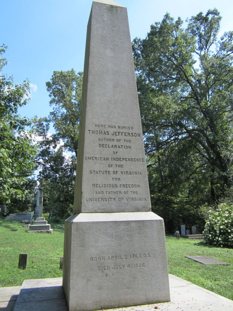
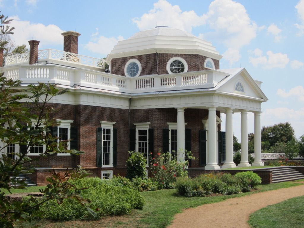
Our story continues next week with an article on the Museum of the Confederacy - Appomattox Annex. The following week will be an article about the Charlottesville KOA campground. Following that will be an article about Monticello, Thomas Jefferson's home. Part III of this article will continue the week after that.
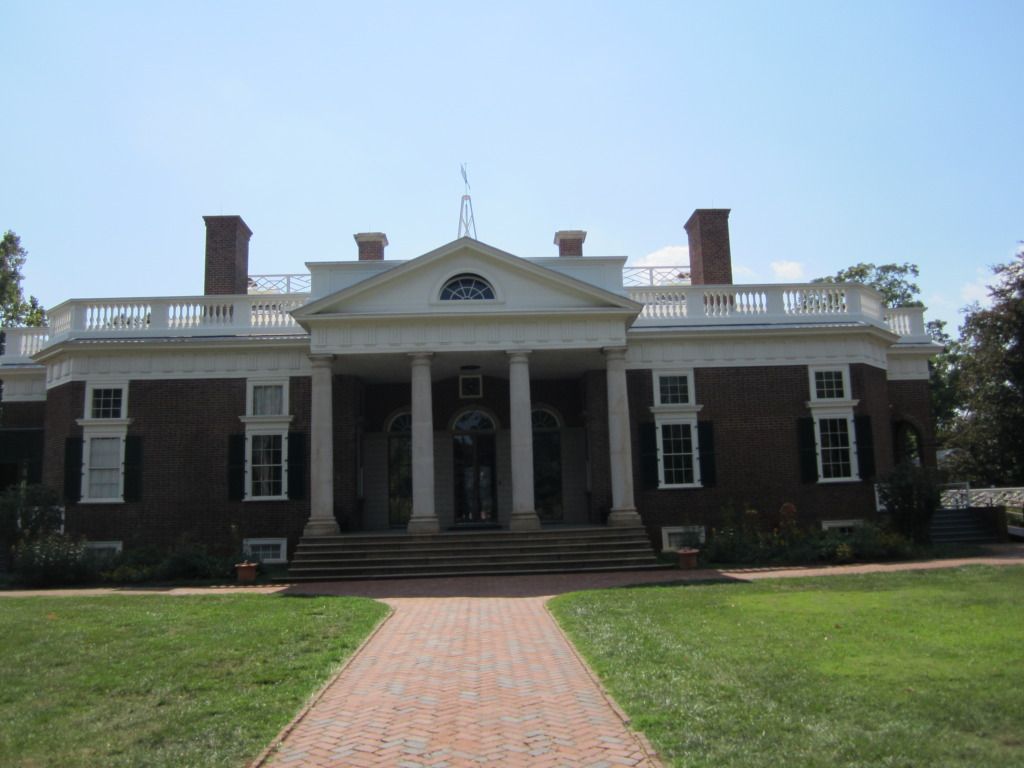
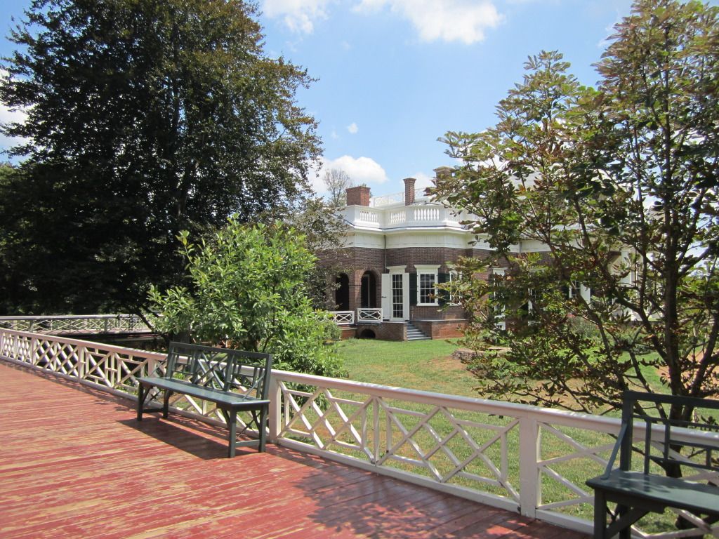
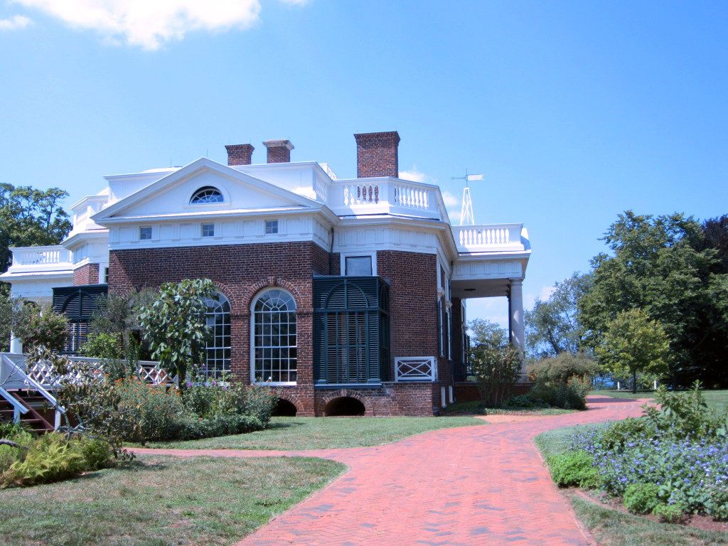
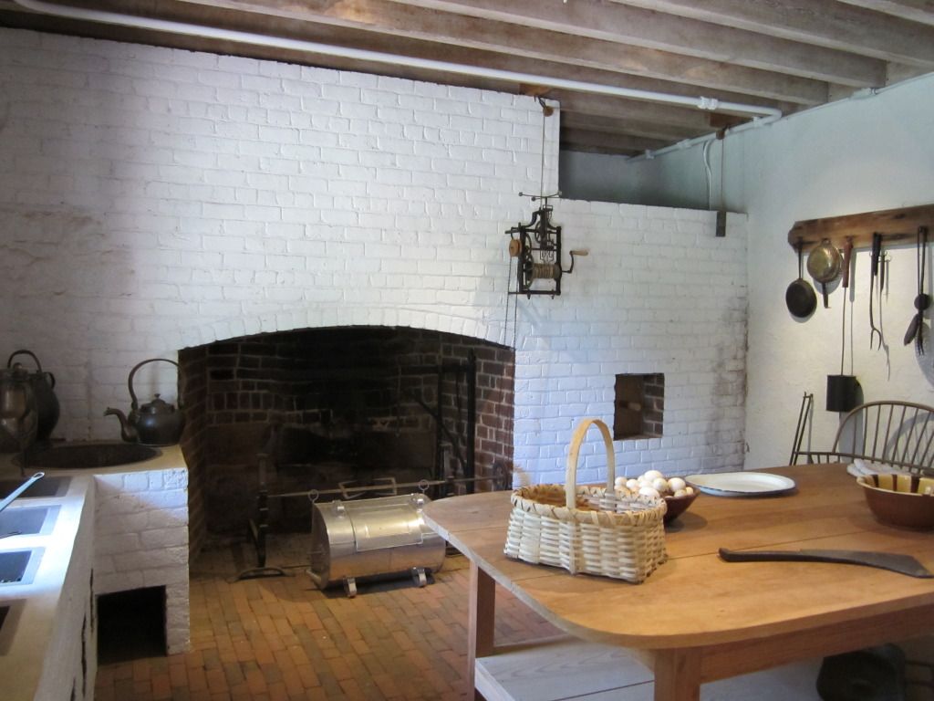
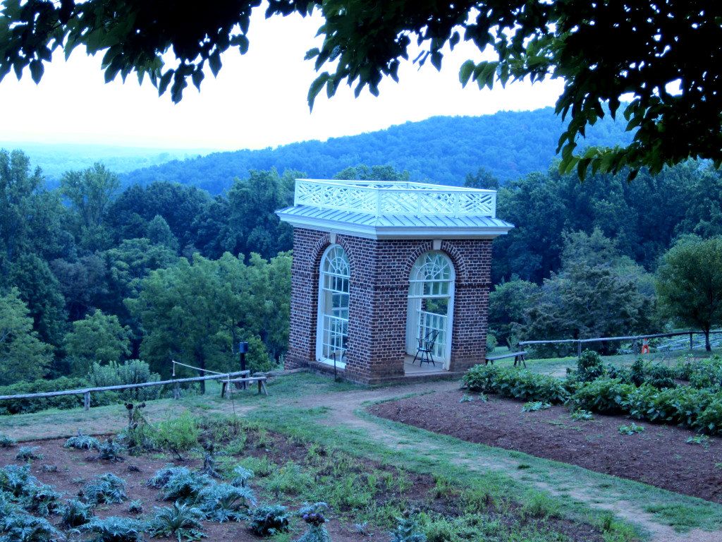
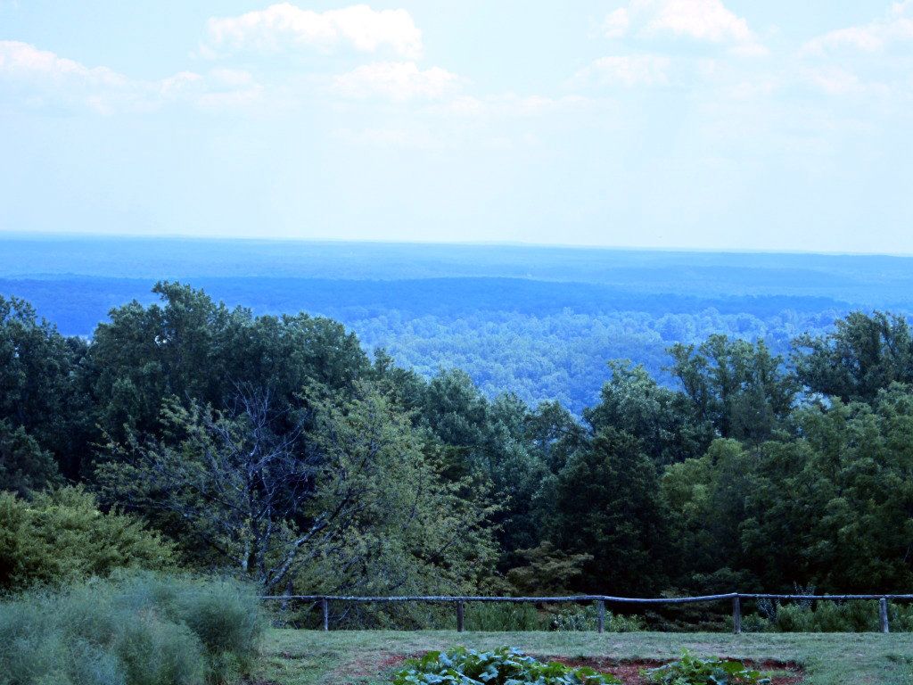
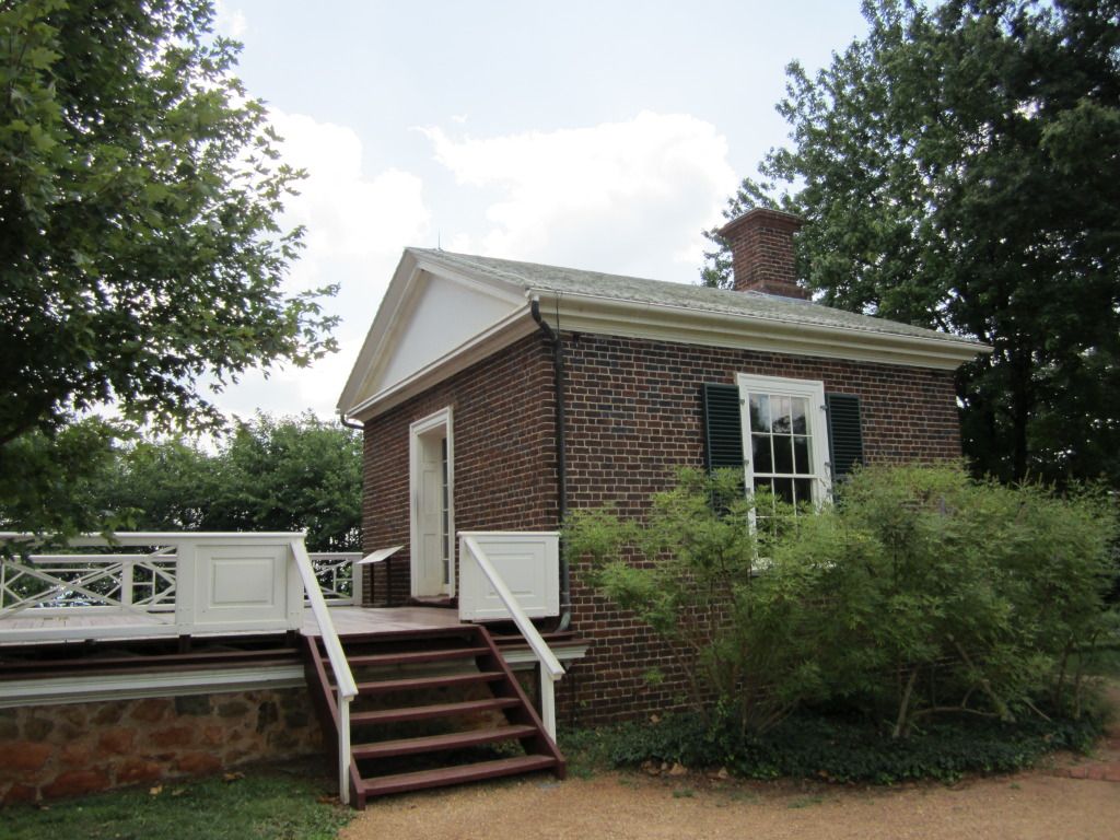
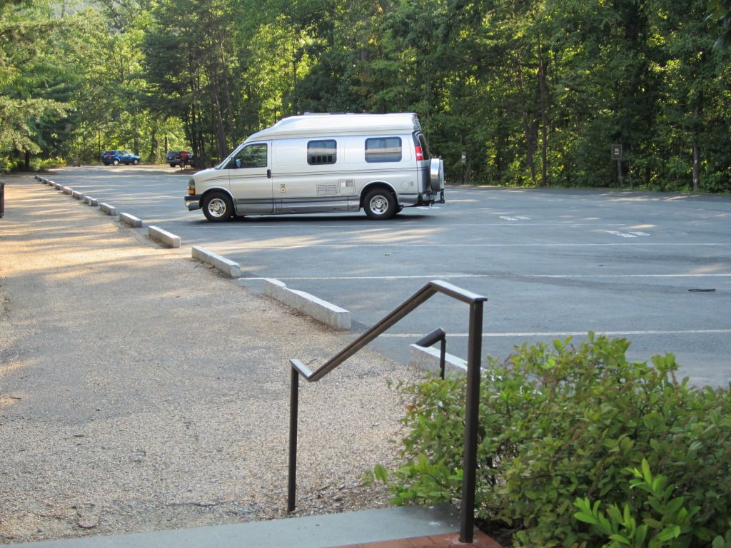