Continued from
Part I
We spent the night at the KOA RichmondNorth campground, as I wrote about last week. That morning we were heading off to do some sight seeing before we continued along to our next campground in Charlottesville, Virginia. We were about to head west into the mountains and into central Virginia. Our destination was Appomattox, Virginia, the site where General Lee surrounded his army to General Grant to start the beginning of the end of the Civil War.
We have been to Charlottesville many times but we have never been there in an RV and we had never taken this particular route to get there. I did a lot of planning of the route to take looking at Google Maps and the satellite views to see what I was taking the Roadtrek into and what the roads would be like that I would be taking the Roadtrek on. Many of the satellite views were nothing more than trees - no road in view that was there beneath those trees. I came up with what looked like a good route. It included going a bit out of the way further west to take a much larger road/highway back north toward Charlottesville, than taking the twenty minute faster route that took us twisting back through mountain roads. We would be taking part of that twisting mountain road to get to Appomattox, but I did not want to take it as the route all the way up. So, after consulting with Meryl, I routed the Tom Tom to go the longer route. I had all of the routing to and from new places completed almost a month before the trip.
Two nights before we were leaving, I decided to look at the website for the campground in Charlottesville. I had been on the KOA website and saw the full description of this campround, but I had not, for some reason actually looked at the campground's own website. I looked at the directions that the website had to get there and then - uh, oh - I saw this:
WARNING: DO NOT take exit 120 off I-64 as some GPS and online maps may suggest. This route (631/Old Lynchburg Rd) is not recommended; it is very narrow and has sharp turns! We also DON'T recommend route 708/Red Hill Rd coming from route 29 if you are driving an RV. IGNORE YOUR GPS!
My route was going exactly how they were warning you not to go! Oh boy. I immediately went out to the Roadtrek, got the GPS out of the dashboard, and started re-routing to the campground. I still did not want to take Route 20 all the way up and I did want to take the longer and straighter Route 29 that I had planned, but I had to make some changes to avoid approaching the campground from the west and come onto the access road from the east (which is basically what they are saying in the warning). This added another ten to fifteen minutes to the route. Lesson to be learned- always check the campground website location and directions page. I have seen warnings like this before for other campgrounds in various places.
So, OK. We were all routed and off into the mountains. With no surprise, the weather forecast was "Scattered Showers and Isolated Thunderstorms". What else was new? It was overcast but it was not raining. The road surfaces were dry and visibility was clear. That was what was important.
I have to share that the Roadtrek handled some steep roads quite well. There is plenty of power in my 6.0L 8 cyl. engine with its six speed transmission. There were a few spots where I had to push the gas pedal a little further down, and the engine would roar a bit, but following a little hesitation the Roadtrek went back up to speed. Of course, on some of these roads we were not driving much faster than 45 mph and on some of these roads where the speed limit was higher, I was not comfortable bringing the Roadtrek up past 45 mph considering the single lanes in each direction and the twists and turns that the roads made. I am sure I was not making some of the little cars that knew these roads well that were driving behind me very happy, but I was going to drive the Roadtrek as safely as I felt necessary.
We made the trip to Appomattox pretty much in the time that the Tom Tom predicted on its screen. As we were driving along, Meryl had the task of checking cell phone signals on the new cell phone that I had got just before we left on the vacation and comparing this new company to her cell phone on the company that we have had as our cell carrier for years. We were driving through areas where cell phone voice, and especially data, signals are weak to poor - for all of the companies. My new phone had service pretty much where her phone had service - and where she did not have any service at all - and there were quite a few places like that along the route - I did not have service either. Along the way we listened to recordings of the old Burns and Allen radio show on a CD and laughed our way west.
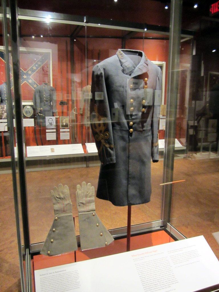
We arrived in Appomattox and the first attraction that we wanted to see was the newly built musuem that is an addition to the Museum of the Confederacy in Richmond. I will write a separate article about the museum next week. We had to have lunch before we stopped there and the night before we had checked the internet to see where the closest McDonald's was. There generally is a McDonald's just about everywhere you go - and while we could have stopped and made lunch in the Roadtrek, it is far easier to stop for twenty minutes or less and eat and go. We had an address for it in the commercial area of the Town Of Appomattox but we did not look on a map. As we passed the museum, we saw a sign for the road the address was on - but the sign came up quickly and I missed the turn. Remember in the Roadtrek don't try to make any sudden fast turns. I kept going looking for a place to turn around. This is also another not easy thing to do when driving the Roadtrek. I saw a wash it yourself car wash up ahead and turned in. I had not realized as I pulled in that the exit out was very steep. I pulled around the little corner parking lot and was going up hill. The exit dropped off to the road. As I turned out of the exit and onto the street, I could hear a bang in the rear of the Roadtrek. I did a lot of cursing and wondered what damage I did now. We headed back to the road that we missed and got on it and seemed to be driving for a lot longer than the mile that this McDonald's was supposed to be and the road was becoming a limited access road. We pulled off at the next exit and started heading back in the direction we assumed we had to go. That direction was fine and we learned along the way that the road we wanted was the "business" route of the road with the same name and we were on that now. And there was the McDonald's up ahead with a sharp turn through traffic off to the left and into a very small parking lot.
Fast food restaurants do not always have large parking lots and we have encountered several of these in the Roadtrek that really have no place for the Roadtrek to park without sticking way back into the active entrance or exit lane. This was one of those lots. I pulled into a space with the drive through line behind me and hoped for the best while we were inside. Before we went inside, I looked as best that I could under the Roadtrek for the source of the big bang that we had heard when making the turn around. There was nothing obvious - and to date, nothing is wrong - thank goodness. We ate and got back out to go back to the museum we wanted to visit.
The GPS already had the museum as the next destination and it told us to go straight on the road that the restaurant was on and then within a block turn right. OK. I wondered where it was taking us. Well, it took us to the street that we came in on passed the musuem. The same street that the car wash that I turned around at was on, and in fact, there was that car wash up ahead as we turned onto that road. The museum was about thirty seconds further down. Had we stayed on that street coming in, we would have seen the McDonald's as soon as we came to its intersection. And avoided that bang... Oh well.
I will tell you about the musuem next week. I will move along now to the trip up to Charlottesville which was happily uneventful. By the time we came out of the musuem it was too late to visit the actual site of the surrender which is in a National Park right there. We have been to that site before and there is a campground right across the road. When we decide to head back here, we will likely try that campground and spend more time here.
We made our way along the route that I planned and drove in and out of towns - some looking like they have not changed in 75 years, and some looking very much like every other commercial, built up town in the country with shopping malls and lots of retail along the side of the road. As my route got further along, the main route that I decided to travel stopped being a limited access road and became more of a two lane in each direction open highway through towns. And it went up and down the mountains. The big 18 wheeler trucks seemed to do much better going up and down the mountains than the Roadtrek, but the Roadtrek held its own.
As we got close to Charlottesville, we passed the road that the campground was on from the direction that we were warned not to take. We passed it by and continued up and around and back east, and then headed south exactly where the campground directions specified. If this is the better route, I thought, what must the bad route be like? It twisted around and down the mountain. It twisted a lot and the speed limit was 55 mph and the road was one narrow lane in each direction. I was, of course, not doing the speed limit. I was driving between 40 and 45 mph with an eye on the warning signs that would come up to reduce speed down to 35 - which I was sure to do. It was a little bit of white knuckles on the steering wheel for a while. There was, luckily, a sign just before the turn to the road for the campground and the Tom Tom was doing a good job at notifying me of turns coming up. The road that the campground is on was not much better and at one point we came to a sign that said single lane bridge. This is a road that trucks drive on and I was very happy to see the truck behind me turn off. I was not going to miss the campground entrance - who knew where we could turn around and ahead we would be on the part of the road we were warned about. I reduced down to ten miles per hour and we both looked sharp for the campground entrance. It was well marked - and the Tom Tom announced it was up ahead. We turned into the campground - the Charlottesville KOA which is actually the only campground that I could locate in this area and within a number of miles of this area. I will write about the campground in an article in two weeks.
We were heading out for dinner that night to a restaurant that we have been to before in Charlottesville. At the campground I asked the very nice couple behind the desk in the registration office how much worse is the road that they warn about over the road that they recommend. I was told that the warning is really for much bigger RVs and trailers than ours but - there are a lot more twists and turns and some turns are very sharp. When were pulling out for the restaurant I turned to Meryl and asked if we should try that other direction - just to see it. Silly me... Meryl said OK and I made a right out of the campground. At first the road was pretty much OK. There were some houses on the side and a few businesses. Then it started to twist and there were - as warned - several very sharp turns. I drove slow and cautiously. One of those turns sharply curved around what might be called a wooded glade that then looked like more of a swamp. You certainly did not want to go off the edge of the road there. As we came out onto the main highway it started to rain. And then it started to pour. I mean pour like someone opened a faucet and a steady, heavy flow of water came down. Thank goodness the rain waited for us to get out off of that road.
It rained heavily for about an hour. It was actually too early to eat dinner when we got to the restaurant. There was a supermarket across the parking lot and we decided to go in there and spend some time. We put on our rain jackets and went out into the storm. While we were in the supermarket, the sky started to lighten and then as suddenly as the storm started it just stopped completely - and the sun came out. At least, if it stayed this way and did not start raining again when we had to return to the campground, I would not be driving back down the twisty recommended road in the rain - the dark would be bad enough.
End of Part II - see below...
Our story continues next week with an article on the Museum of the Confederacy - Appomattox Annex. The following week will be an article about the Charlottesville KOA campground. Following that will be an article about Monticello, Thomas Jefferson's home. Part III of this article will continue the week after that.